Glaciers in the Scinde Valley – Cashmere
Samuel Bourne
English photographer who arrived in India in early 1863. During the summer of that year Bourne traveled to the Himalayas where he states in an article in the British Journal of Photography, he decided “to see what elements of beauty and grandeur lay concealed in some of the higher and little known regions of the Himalayas.” This was followed by two more excursions into the Cashmere [Kashmir] and the Himalayas (1865-1866). Bourne’s determination to photograph the most picturesque and remote areas of Northern India resulted in the finest examples of scenic photography ever produced by a single photographer. This group of photographs represents just that.
The high quality, fine contrast and tonality of the prints that are more than 140 years old, demonstrates not just the artistic skill of the photographer, but of the attention to detail in the printing of the images.
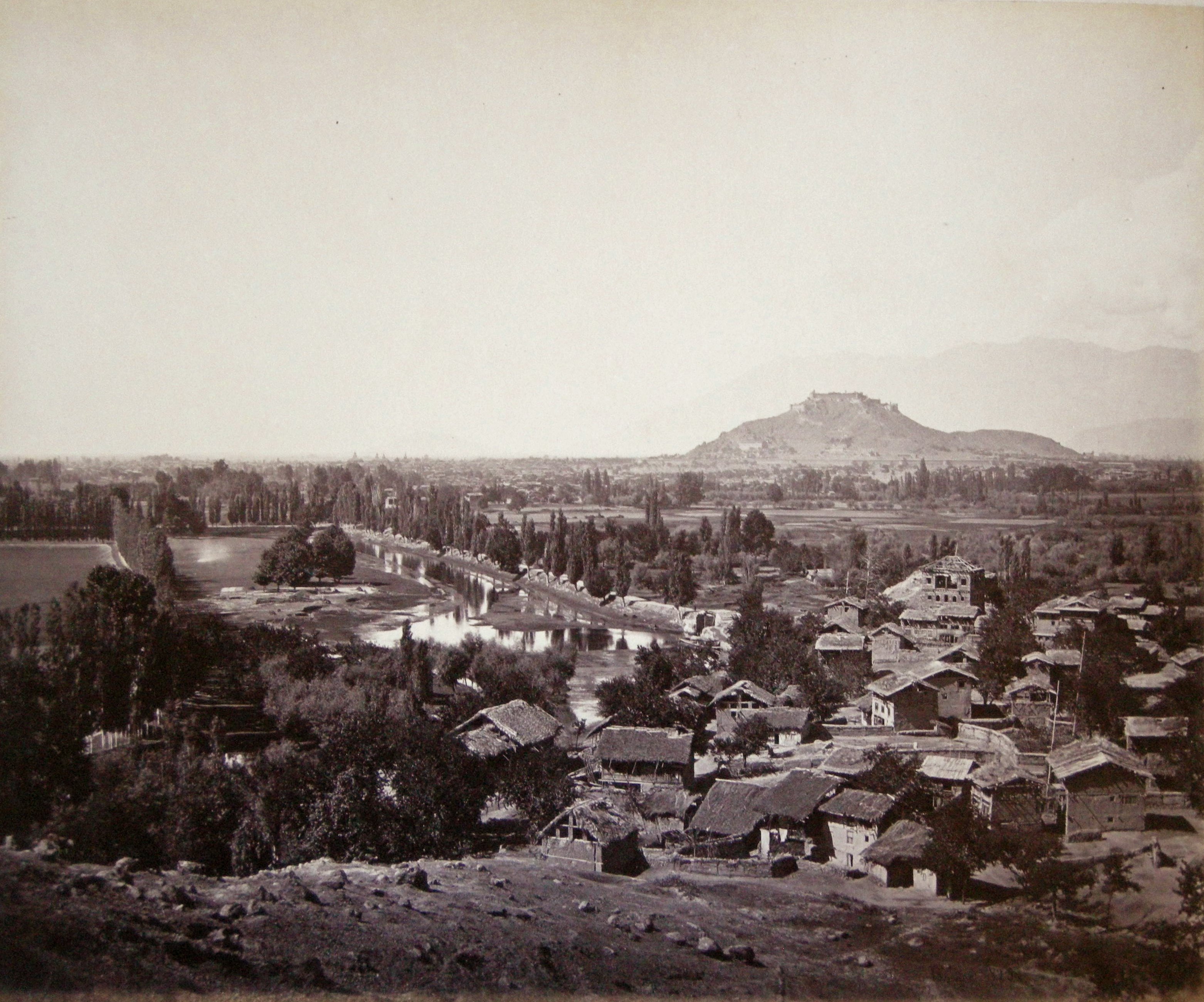
View of Srinuggur – Cashmere

View on the Kholee, Kangra Valley

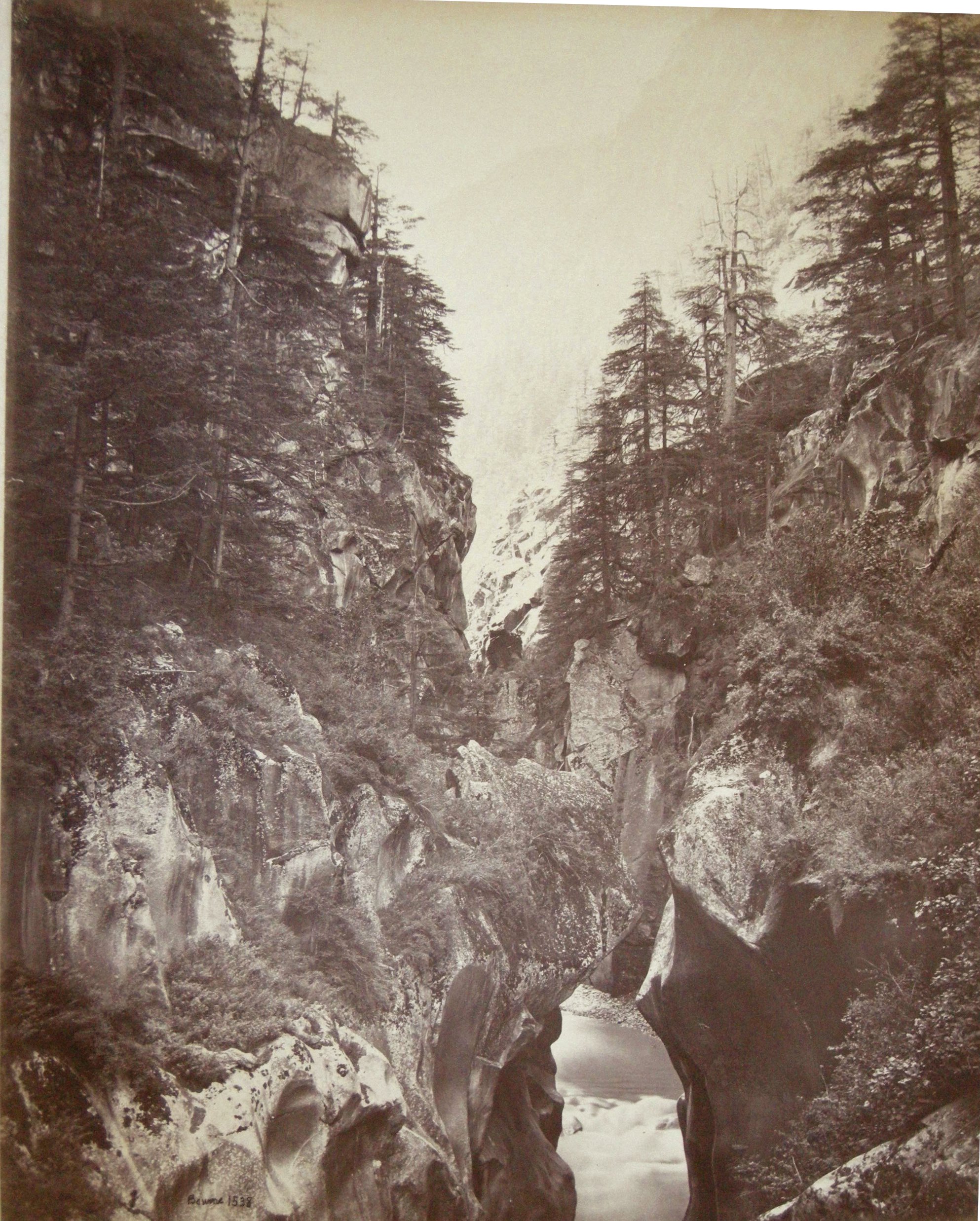
Rocky Channel of the Ganges at Bhairamghati
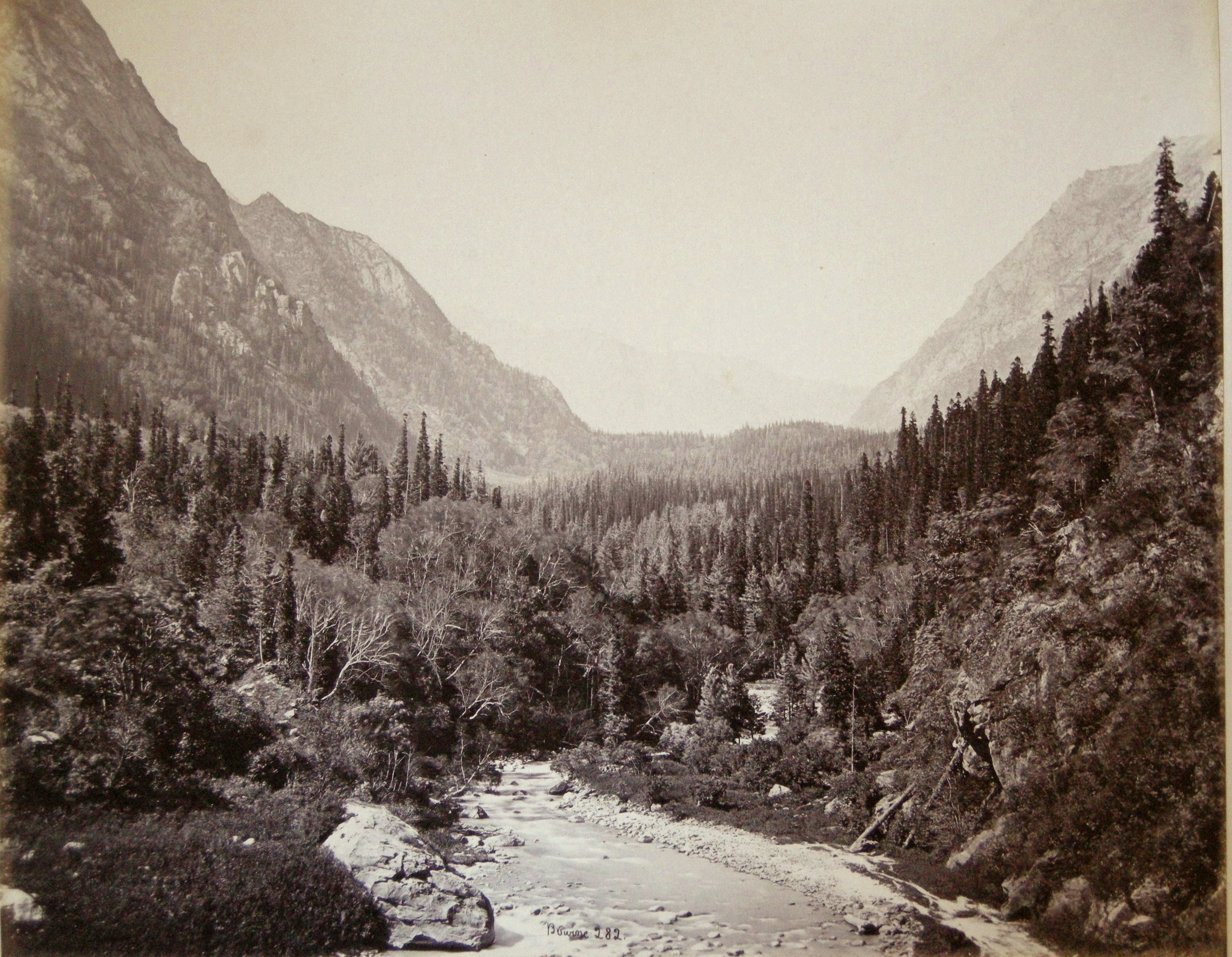
General View of the Wanga Valley

The Thibet Road across the Rogi Cliffs

View from the Thibet Road at Pangi, & the Great Chini Peaks
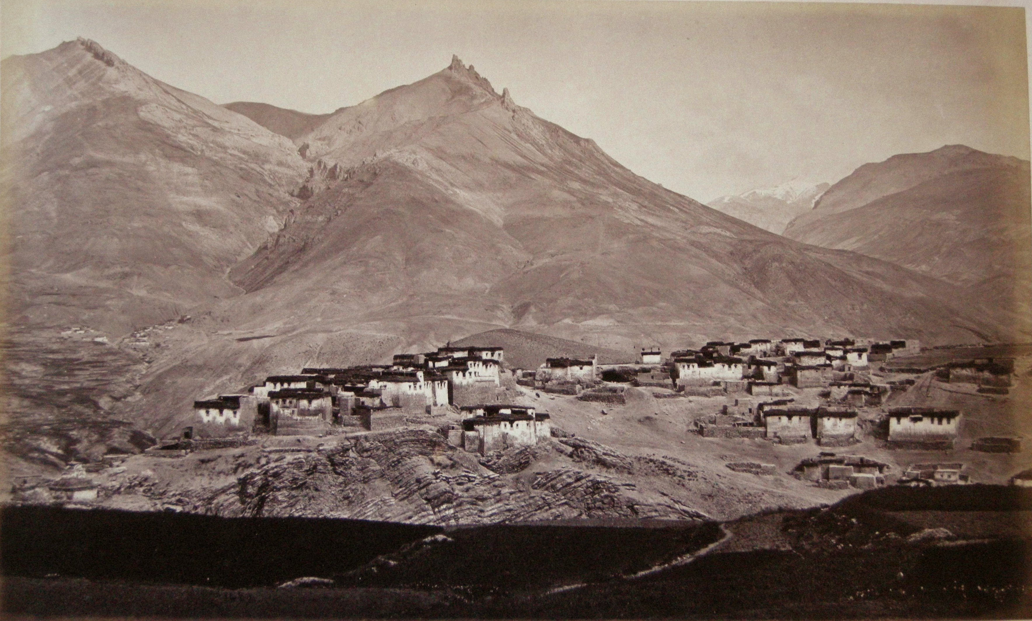
The Village of Kibber – Spitti

Great Snowy Peak, South of Hamta Pass

The Manirung Pass – Elevation 18,600 Feet
Some of Samuel Bourne’s journals were published in the British Journal of Photography commencing on 26th November, 1869 under the title ‘A Photographic Journey through the Higher Himalayas.’ His description of the Top of the Manirung Pass, (#1468) gives us some idea of the difficulty in photographing this remote area of the World.
“Before six we were on the move, and at half-past eight I stood on the crest of the Manirung Pass, at an elevation of 18,600 feet above sea! But how shall I describe such a situation, or convey to the reader any idea of the wondrous extent of view which spread around me?
From my very feet rose the Manirung Peak, 3,000 feet still higher, forming the northern boundary of the Pass. Across the glacier on the opposite side was a somewhat lower range, presenting a singular contorted structure in those parts not covered with snow. Looking towards the east and south, a mighty succession of snowy ranges stretched beyond the limit of vision into the vast unexplored regions of Thibet, and beyond the sources of the Ganges and Jumna to the sacred shrines of Kedarnath and Budrinath. Looking to the west, the barren, snow-capped mountains of Spiti were visible in all their rugged grandeur, and the Spiti river gleamed like a thread of silver through the now hazy valley down which I had come. I seemed to stand on a level with the highest of these innumerable peaks, and as the eye wandered from summit to summit, all robbed in the silent whiteness of eternal winter, it seemed as though I stood on a solitary island in the middle of some vast polar ocean, whose rolling waves and billows. crested with foam, had been suddenly seized in their mad career by some omnipotent power and commanded to perpetual rest. All was still and serene; the sun poured his still hot beams through the clear ether, and made the sun sullied snow dazzling and painful in its brightness.
When the first feelings of surprise and admiration were satisfied I was anxious to set to work to record some impressions of these grand scenes, but alas! all my paraphernalia was behind. My poor coolies could not climb so fast as I had done, and I saw them far below apparently almost motionless beneath their burthens. I sent some of those who had arrived with lighter loads ti hasten and help them on, for there were not wanting signs already to show that what I did must be done quickly or all would be lost. It is a rare thing to get a clear day at such an elevation as this, and I considered myself wonderfully favoured. But the view to the east was gradually becoming obscured by clouds which I was afraid every moment would shut out all; but, fortunately, though they came rolling up to my very feet at the crest of the Pass they came no further, but seemed as it were to turn back, as though they would wait and give me an opportunity to secure some record of these sublime scenes so rarely visible.
Every minute seemed like an hour as I waited the slow arrival of my boxes, and it was not till eleven o’clock that I could commence operations. I had just time to secure three negatives before the clouds which I had marshalled themselves into vapoury ranks behind me, rolling and seething, anxious to come on, but apparently could not till my operations were finished, at length rushed over the scene, and I saw its sublimity no more.
The running about in the soft snow to get these pictures at such an elevation was a work of no small difficulty, on account of the rarefaction of the air. With the chemicals I had no trouble, the exposure (the subjects being largely composed of snow) was very short, not more than seven or eight seconds with a Grubb’s C lens, fifteen inches focus, and smallest stop. I am not aware that any other photographs have ever been taken at so great an elevation as this; and had these been less perfect than they are I should have still valued them, and they would have been interesting on this account.
(The spelling and punctuation is Bournes. He was correct that nobody had ever taken photographs at this altitude at that time in 1866.)

Wooded Valley from Fualdarn – The Srikanta Peaks in the Distance

Hindoo Temples on the Ganges at Derali
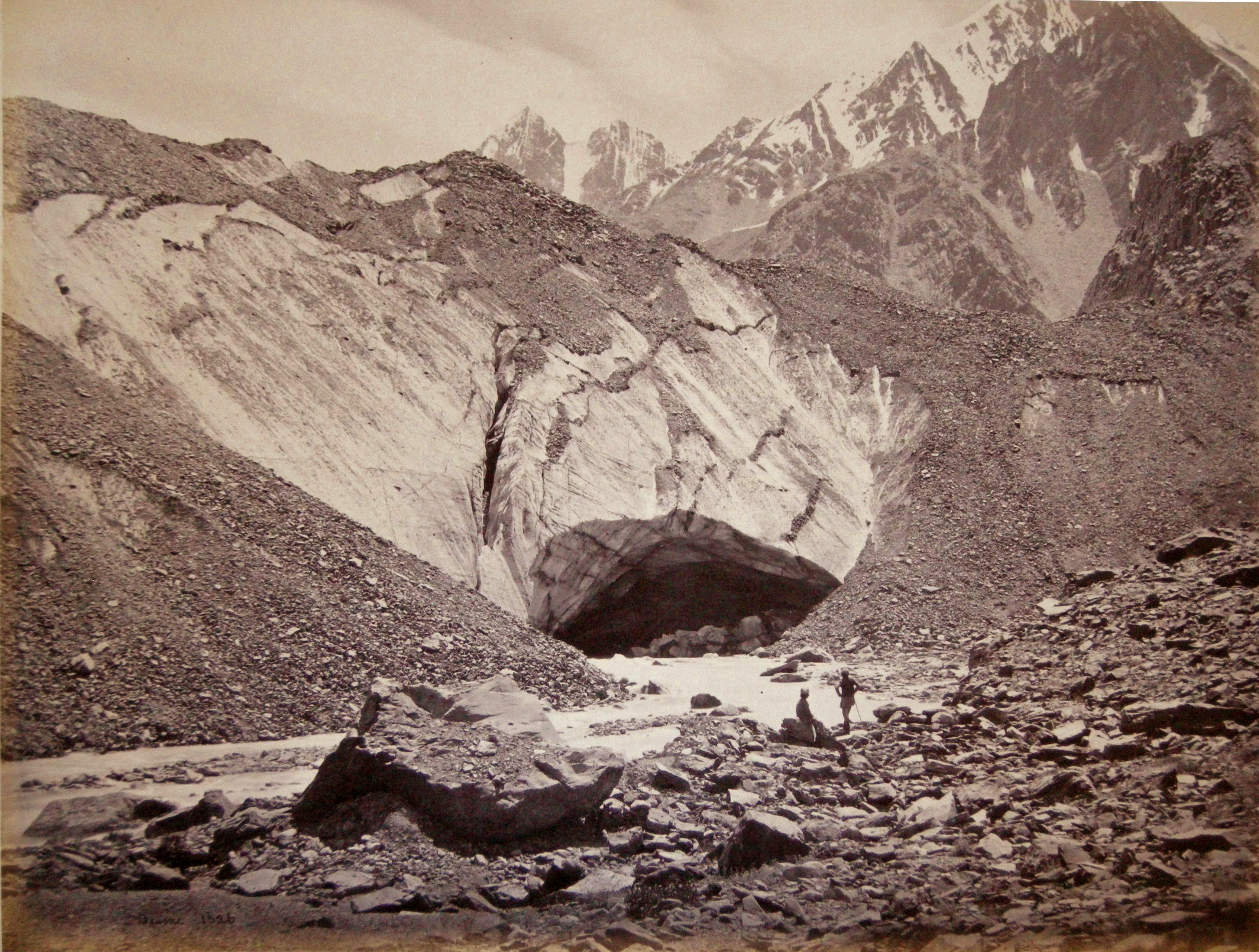
Ice Cave in the Glacier – Source of the Buspa

The Village of Dunkar – Spitti

Mount Moira (22,621 Ft.) from the Gangootri Glacier

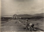
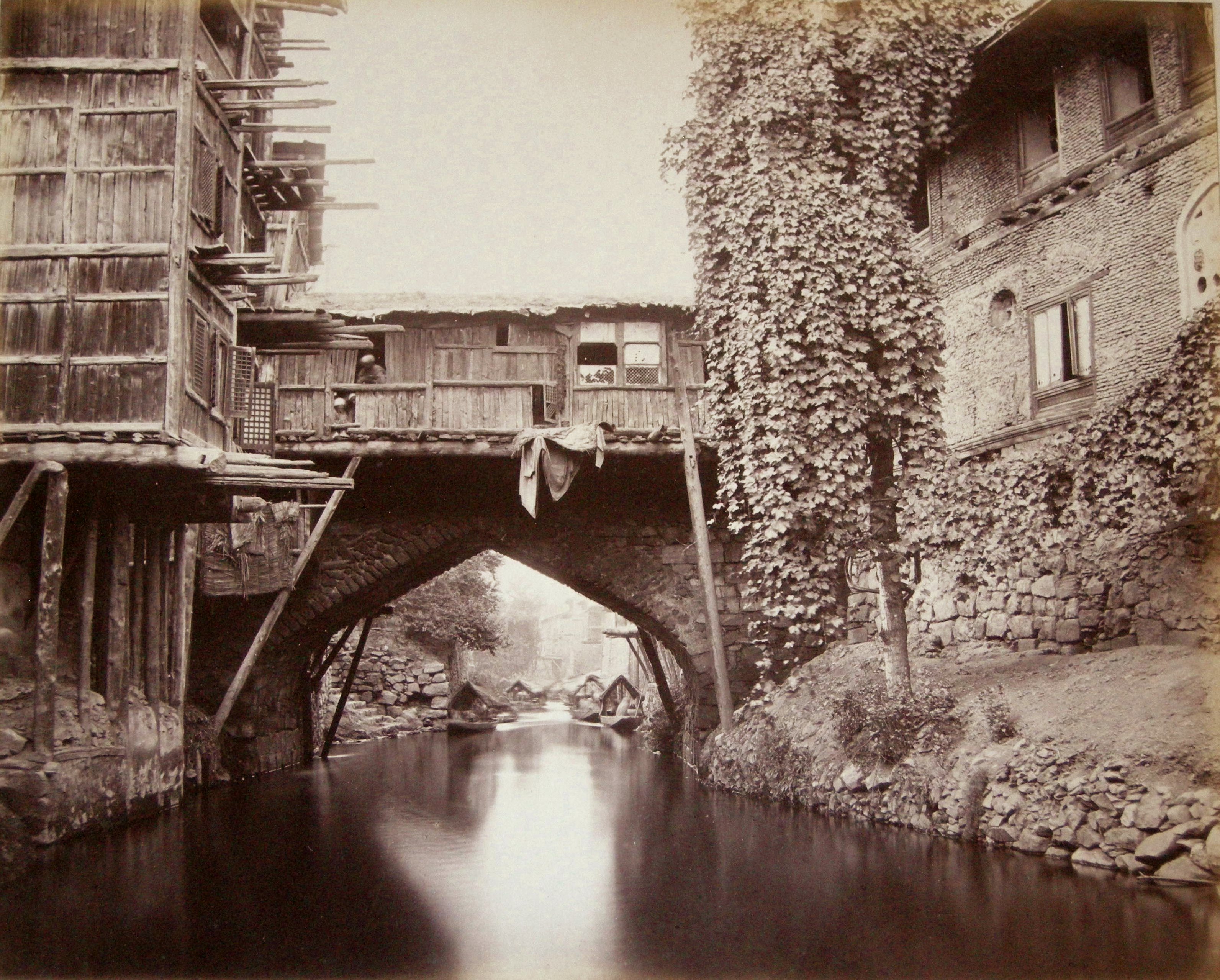
Bridge of Shops at Srinuggur

Ancient Hindoo Temple and Pipul Tree – Bheem Tal
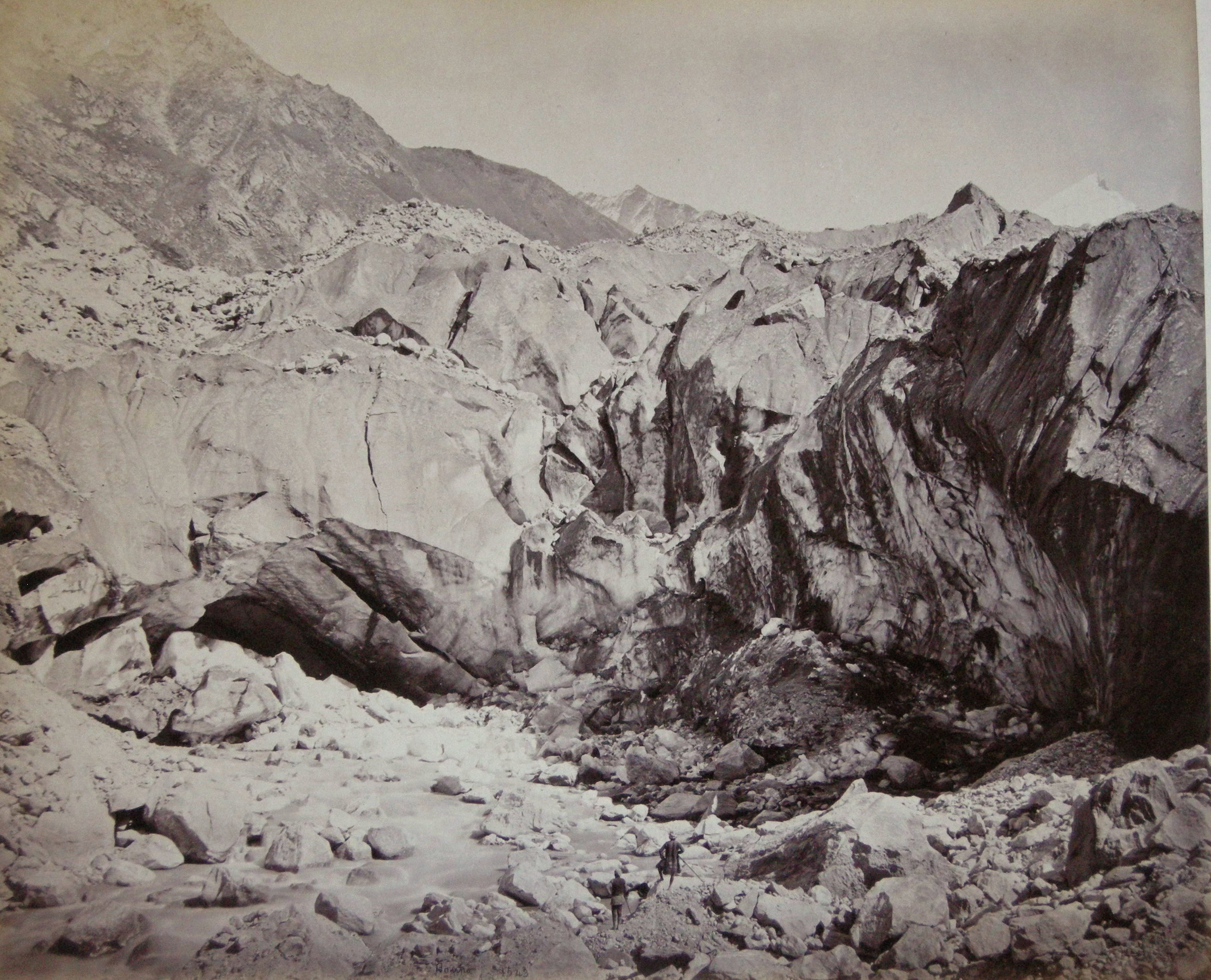
Ice Cave in the Glacier – Source of the Ganges
Bridge over the Marqual Canal – Cashmere

Cane Bridge over the ‘Runjeet’ Below Darjeeling

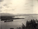
View of the Ravee at Chumba

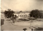
A ‘Peep’ at the South End of the Lake – Nynee Tal

View on the Dhul Canal – Cashmere. Prize photograph 1865
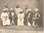
India in the 19th century is shown in this post, the places and the people, a fascinating journey, seen through the eyes of mainly European photographers.